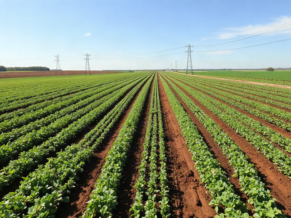
Strip farming methods conserve field soil by alternating erosion-prone crops with dense grass, legume, or small-grain strips that slow runoff, shorten uninterrupted slope length, and trap displaced sediment. Contour strips work across sloping ground, while field strips suit flatter land where wind or gentle water movement is the main concern. Effective layouts follow actual water flow, maintain protective strips wide enough for equipment, and provide stable outlets for concentrated runoff. Poor alignment, excessive row-crop width, and tillage that channels water downhill can undermine the system even when the crop rotation appears sound.
How Do Strip Layouts Control Soil Erosion?
Strip layouts interrupt the long, exposed path that water or wind would otherwise travel across a cultivated field. A band of close-growing vegetation places stems, leaves, and surface residue in the path of moving soil. Runoff slows, infiltration has more opportunity to occur, and some detached particles settle before leaving the field. The system is most useful where a continuous block of row crop would expose too much loose soil between planting and canopy closure.
The protective effect comes from the relationship between the strips, not merely from planting two crops in the same field. Corn, soybeans, or another widely spaced crop may occupy the erosion-prone bands, while hay, pasture grass, clover, or a small grain provides denser cover. Alternating those bands reduces the uninterrupted slope length. On wind-exposed ground, the change in crop height and residue also roughens the surface and limits the distance over which wind can gather enough force to move dry particles.
A practical example is a rolling field planted entirely to corn in previous seasons. During intense rain, water may accelerate down the rows, cut shallow channels, and deposit silt at the lower boundary. Replacing selected bands with a grass-legume sod can intercept that flow. The sod is not a substitute for correcting a gully or installing a suitable waterway, but it can reduce sheet and rill erosion between defined drainage paths.
Uniform-looking bands can still fail when they ignore field hydrology. Water rarely follows the neat geometry shown on a sketch. It follows depressions, wheel tracks, compacted headlands, and changes in slope. A strip that ends at a low point may concentrate runoff at its edge, creating a new erosion problem. Before marking boundaries, walk the site after rain and identify where water spreads broadly, where it converges, and where sediment accumulates.
Signs that the layout is working include residue remaining in place, fewer soil deposits at the foot of the slope, and no new rills crossing crop bands. Warning signs include muddy runoff, sediment fans below row-crop strips, water ponding against a dense band, or channels forming along strip boundaries. Those symptoms call for adjusted alignment, narrower cultivated bands, better residue cover, or a stable outlet—not simply another pass with tillage equipment.
Which Strip Farming Pattern Fits the Field?
The correct pattern depends on whether erosion is driven mainly by downslope runoff, wind, or irregular terrain. Contour strip cropping is generally the strongest fit for sloping fields because its boundaries follow lines of similar elevation. Field strip cropping uses straighter, more uniform bands and is better suited to gentle slopes or broad fields where machinery efficiency and wind protection are larger concerns. Buffer strips place permanent or long-lived vegetation beside vulnerable features such as drainageways or field edges.
| Pattern | Best suited to | Main planning concern |
|---|---|---|
| Contour strips | Rolling ground with sheet or rill erosion | Keeping boundaries close to the true contour |
| Field strips | Broad, relatively uniform fields | Orienting bands across erosive wind or gentle runoff |
| Buffer strips | Drainageways, lower slopes, and sensitive edges | Preventing concentrated flow from cutting through vegetation |
Contour strips require more field-specific layout work. A line that appears level from the tractor seat may rise or fall enough to direct water along the boundary. Simple elevation checks, field mapping, or assistance from a local conservation professional can reveal those deviations. On complex slopes, a perfectly parallel pattern may be impossible. Short point rows or variable-width strips may be safer than forcing every band into a rigid rectangle.
Field strips exchange some contour precision for simpler operations. Straight bands reduce turning difficulty and make planting, spraying, and harvest easier, especially when equipment is wide. They should still cross the dominant direction of erosion rather than run with it. Straight strips running directly downhill may create long flow paths and provide little protection between vegetated bands.
Buffer strips serve a different role. A grass band bordering a waterway can filter shallow, spread-out runoff, but it should not be expected to absorb a forceful stream from an entire hillside. Concentrated water needs a stable conveyance route designed for the site. Likewise, a narrow grassy edge cannot compensate for bare soil across a long upper slope.
Choose the pattern after identifying the dominant problem. If small rills repeatedly appear after storms, prioritize contour alignment and shorter cultivated slope lengths. If the surface blows during dry spring weather, orient strips across prevailing erosive winds and retain residue. Where both pressures occur, a combined layout may be warranted, but operational complexity rises with every additional boundary.
Planning Strip Width, Alignment, and Field Access
Strip width should balance erosion control with workable equipment passes. Narrower cultivated strips interrupt runoff more frequently, but widths that do not match planters, mowers, sprayers, and harvesters lead to overlaps, skipped ground, awkward turns, and repeated wheel traffic. Begin with the working width of the equipment that is hardest to accommodate, then evaluate whether the resulting multiple is suitable for the field’s slope and erosion risk.
There is no responsible universal width for every field. Steeper slopes, highly erodible soil, sparse residue, and crops with wide bare rows generally call for shorter distances between protective bands. Gentler ground with strong residue cover may tolerate broader bands. Soil texture matters as well: surfaces that seal readily can produce runoff even when the slope appears modest, while recently tilled, dry soil may be especially vulnerable to wind.
A useful field-planning sequence is:
- Map the hazard. Mark ridges, slope breaks, seep areas, existing rills, waterways, and sediment deposits.
- Establish controlling lines. Place initial boundaries across the dominant movement of water or wind rather than copying a property line.
- Fit equipment modules. Adjust band widths to full machinery passes without allowing convenience to override erosion risk.
- Plan outlets and turns. Keep concentrated runoff away from vulnerable strip ends and avoid excessive traffic on wet headlands.
- Inspect after establishment. Review the layout after heavy rain and during windy, bare-soil periods.
Field access deserves attention before seeding perennial cover. A protective strip that blocks the only practical route to another parcel may eventually be driven over, compacted, or removed. Headlands must also be wide enough for safe turns without repeatedly damaging the sod. Where irregular boundaries create small wedges, assigning those areas to permanent vegetation may be more practical than planting inefficient point rows every season.
A common mistake is making every strip identical because symmetry is easy to measure. Variable terrain rarely rewards that approach. A convex shoulder may shed water rapidly and need a narrow row-crop band, while a flatter bench can accept a wider one. The layout should respond to the field rather than force the field into a diagram.
Review the plan as an operating system, not a one-time installation. Crop choice, equipment ownership, rented machinery, and field entrances can change. Preserve the erosion-control purpose when revising boundaries, and avoid widening cultivated bands merely to reduce passes unless field observations show that protection remains adequate.
How Should Crops, Tillage, and Runoff Be Managed?
Strip farming performs best when crop rotation, residue, and tillage reinforce the physical layout. Dense strips need enough living cover or surface residue during the periods when adjacent soil is most exposed. A hay strip that is renovated at the same time neighboring row crops are being established can temporarily leave the entire slope vulnerable. Staggering disturbance preserves an effective barrier.
Rotation also determines whether the protective bands remain productive parts of the farm. A grass-legume mixture may supply forage and improve traffic tolerance, while winter grain can provide earlier seasonal cover but may not create the same long-lived sod. The choice should reflect livestock needs, available harvesting equipment, herbicide compatibility, weed pressure, and the intended length of the rotation. Planting a crop that has no practical use often makes the strip the first area neglected.
Tillage direction can either support or defeat the design. Operations that leave furrows running downhill can channel water through a row-crop band before it reaches protective vegetation. Working across the slope, retaining crop residue, and minimizing unnecessary soil disturbance generally reduce that channeling. Contour tillage alone, however, should not be treated as adequate where runoff has already formed a defined gully.
Consider a mixed homestead field rotating corn, oats, and a clover-grass forage. The forage bands can remain in place while the cropped bands rotate, then the roles can switch after the sod phase has served its purpose. That approach distributes perennial cover over time without requiring every strip to grow the same crop indefinitely. The transition must be timed so that old sod is not removed across multiple neighboring bands at once.
Maintenance centers on observation. After major rainfall, check whether water crossed the bands as a shallow sheet or collected along an edge. Repair bare patches before they become channels, control burrowing or wheel damage, and prevent harvest traffic from repeatedly following the same wet route. During dry periods, look for soil trapped in vegetation and for scoured areas on the windward side of exposed strips.
Strip cropping has limits. It does not repair severe gullies, stabilize failing streambanks, or safely carry concentrated drainage by itself. Terraces, grassed waterways, cover crops, reduced tillage, or other conservation measures may be needed alongside it. The strongest plan treats strips as one layer in a field-wide system and adjusts that layer when visible erosion shows the original assumptions were wrong.
Frequently Asked Questions
Is strip farming the same as contour farming?
No. Strip farming alternates bands of crops or cover, while contour farming aligns field operations across a slope. They are often combined as contour strip cropping.
What crops work well in protective strips?
Perennial grasses, grass-legume forage, clover, and small grains can provide dense cover. The best choice must also fit the farm’s rotation, harvest equipment, and intended use.
Can strip farming stop gully erosion?
It may limit sheet and small rill erosion, but an established gully usually needs a stable drainage treatment. Do not direct concentrated runoff into an ordinary crop strip.
Should every strip be the same width?
Not necessarily. Width should reflect slope, soil vulnerability, crop cover, runoff patterns, and machinery passes. Complex fields may need variable-width bands.
How can a grower tell whether the system is working?
Look for fewer rills, less sediment below slopes, stable residue, and shallow runoff crossing vegetation. Muddy discharge, ponding, or channels along boundaries indicate a need for adjustment.
Conclusion
A sound strip-cropping plan begins with the field’s actual erosion paths, not a preference for evenly spaced bands. Identify whether runoff, wind, or both are moving soil; select contour, field, or buffer strips accordingly; and fit machinery only after the controlling alignment is clear. Protective crops must remain dense when adjacent land is exposed, while tillage and traffic should avoid creating downhill channels or damaged boundaries.
Mark visible drainage patterns after rain, compare them with the proposed layout, and choose widths that provide both adequate interruption and complete equipment passes. Reinspect the field after major storms and during dry, windy periods. If rills, ponding, or concentrated flow appear, revise the layout or add measures such as residue management, cover crops, a grassed waterway, or professional conservation planning rather than assuming the strips will correct every form of erosion.